North Shore & Northern Beaches
Private building certifier in the Hunter’s Hill Council area
On the Hunter’s Hill peninsula, CertifiBuild certifies homes, additions, outbuildings and pools. Two maps matter most here: heritage conservation areas and the map of the river front area. Either one can rule out a code-based approval, so we check both before anything else.
Local plan
Hunters Hill Local Environmental Plan 2012
Bushfire prone land
Most suburbs
Flood planning
Council mapping
Heritage areas
About 46% of area
Most building activity right now
All 6 Hunter's Hill suburbs, ranked by building work
Ranked by ABS building approvals for new homes, duplexes, townhouses and renovations over the 12 months to August 2026. Choose a suburb for its local guide.
Local rules
What shapes approvals here.
Heritage across the peninsula
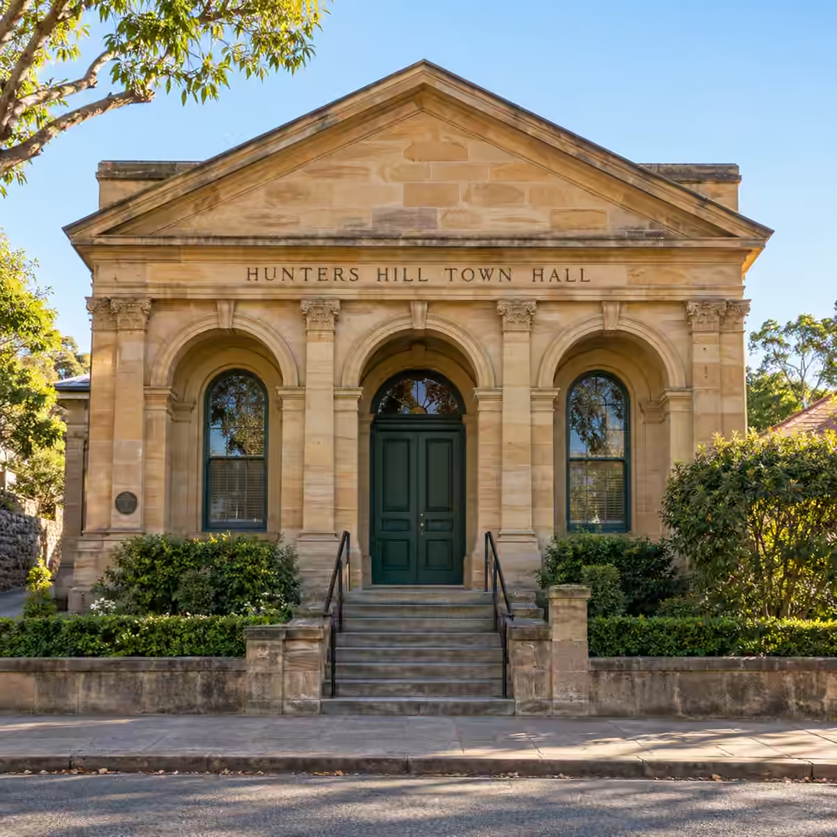
Hunter's Hill is a small peninsula council between two rivers, with the Parramatta to one side and the Lane Cove to the other. The Hunters Hill Local Environmental Plan 2012 lists seven heritage conservation areas. Conservation areas protect the character of the entire street. Together, they cover roughly 46% of the council area. All of Woolwich is inside one. Huntleys Point has no conservation area. Neither do Henley or Huntleys Cove.
On conservation area land, most house works cannot use a complying development certificate (CDC). A CDC is a code-based approval a private certifier can issue. A pool or other detached outbuilding can still take that route. Alterations to older Federation and sandstone homes usually need a statement on heritage impact.
The river front area
It has a separate map of its own. Roughly 58% of the council lies within it, including nearly all of Huntleys Point. Land in this area is excluded from complying development. So suburbs with no heritage controls can still need a development application (DA) to council. Council judges how the home will look when seen from the river, nearby reserves and streets.
Height, garden space and trees
For most houses, height and landscaped area decide the size, not floor space ratio. Across nearly all residential land, buildings may be up to 8.5 metres high, with two storeys as the aim. Sites with direct river frontage need at least 60% of the site as landscaped area. Other sites need 50 per cent.
Tree rules are strict. Consent is needed for plants four metres or taller. It is also required where the trunk is 200 millimetres across, measured 1.4 metres up from the ground.
Where to start
Get a tree survey early, then send it with your site survey, plans and planning certificate. We will check both maps and confirm your approval path.
Local know-how
What changes from one Hunter's Hill suburb to the next
Hunters Hill
The suburb of Hunters Hill lists 335 heritage items. It is known for sandstone villas built by stonemasons from Italy and Italian-speaking Switzerland who arrived from 1855. For alterations, council's design plan keeps houses to two storeys above existing ground. Most external walls are capped at 7.2 metres. Side setbacks are 1.5 metres and rear setbacks 6 metres, with front setbacks matched to the street.
Woolwich
Bushland at Clarkes Point and Kellys Bush means about 26% of Woolwich is bushfire prone land. No other suburb in this council has a bigger share. On those lots, bushfire rules shape materials and design.
Boat sheds, jetties and sea walls are among the few new structures allowed near the shoreline. Council's design plan does not allow buildings and hard surfaces to grow any closer to the water than the foreshore building line. Digging, filling and new retaining walls are ruled out there too. Just behind the line sits a buffer where new buildings are not allowed and paving is capped.
Huntleys Point and Henley
At the 2021 Census, every occupied home in Huntleys Point was a separate house. On the map, lots here must be at least 900 square metres, the biggest minimum this council uses. The eastern tip falls inside the protected setting of Gladesville Bridge, which is on the State Heritage Register. Work there would also need Heritage Act approval. The state harbour rules map around 14% of the suburb as rocky foreshore.
Henley started out as Blandville and took its new name in 1895 from Henley-on-Thames, reflecting its rowing history. Neither bushfire prone land nor a flood planning map applies there. Where single-storey homes dominate, a new upper floor is generally set five metres back from the facade of the ground floor.
Why Hunter's Hill owners and builders rely on CertifiBuild
CertifiBuild takes on house work and Class 10 structures only, such as pools, boat sheds, garages and decks. We spend real time on this peninsula, so we know how its plan, design rules and foreshore controls fit together. We check the heritage, river front and bushfire maps for each lot while plans can still be adjusted. We respond quickly when questions come up and fit inspections around your build program. If a development application is needed, you know early, so the program can allow for it.
Suburbs we cover
All 6 suburbs in Hunter's Hill
We certify homes and Class 10 structures in every suburb listed. Some suburbs cross council boundaries, so we always confirm the council on your planning certificate.
- Gladesville
- Henley
- Hunters Hill
- Huntleys Cove
- Huntleys Point
- Woolwich
Nearby council areas
Neighbouring councils we cover.
Building near a council boundary, or planning another project close by? Each neighbouring council page explains its own local rules.
Our services
From approval to sign-off.
One certifier for the whole job, whichever council your lot is in.
Local questions
Questions we hear in this area.
No two lots are alike. Share your address and we will review the maps that cover it.
All council areasIs a CDC an option in Huntleys Point?
Usually not for house work. Huntleys Point has no heritage conservation area, but almost the whole suburb is mapped as river front area, and complying development cannot be used on that land. So most jobs there need a development application (DA) to council, which looks at how the home appears from the river, reserves and streets. Lots here must be 900 square metres or more, the largest minimum in the council, and the eastern tip is near Gladesville Bridge’s heritage setting. We check both maps for your lot first.
Is house size in Hunter’s Hill set by floor space ratio?
Not usually. In Hunter’s Hill, house size is mostly set by height and garden area. If a house meets those rules, no floor space ratio cap applies. On most residential land, buildings can be up to 8.5 metres high, with two storeys as the aim. Lots with direct river frontage must keep 60% or more of the site as landscaped area, and other lots 50%. In the suburb of Hunters Hill, alterations are also kept to two storeys above existing ground, with most walls capped at 7.2 metres. We test these figures early.
Do I need a tree survey before adding a pool?
It is a good idea. In Hunter’s Hill, you need council’s consent for work on any plant four metres or taller, or with a trunk 200 millimetres wide at chest height, 1.4 metres up. Many established garden trees reach that size, especially on the leafy peninsula lots. A pool must also leave enough landscaped area, which means 50% of the site, or 60% on river frontage lots. Getting a tree survey done first shows where the pool can sit without damaging protected trees. Send it with your site survey and plans.
Building in this area?
Send us the address first.
We check the local maps for your lot, confirm the approval path and quote in writing.